The site comprises 88.5 hectares of agricultural land to the north of Bratton, Telford and forms the majority of a wider allocation in the emerging Telford and Wrekin Local Plan Review.
The site is adjacent to existing residential development to the south. The boundaries of the site are defined by the A442 to the east, the B5063 to the west, existing residential development to the south and open countryside to the north.
A watercourse runs through the site south to east, and a drainage channel runs along the northern boundary of the site. Whilst most of the site is located within Flood Zone 1, and is considered at the lowest risk of flooding, there are areas of Flood Zone 2 and 3 associated with the watercourse, and there are areas of medium-high surface water flood risk within the site. High voltage powerlines run broadly east-west through the southern part of the site.
The Grade II Listed Bratton Farmhouse does not sit within the red line boundary of the site, but sits within an area which the development site extends around.
There are no Public Rights of Way (PRoW) crossing the site. A number of PRoW are located within the vicinity of the site to the west leading towards the villages of Longdon-on-Tern and down to Allscott. Providing an extensive network of new public walking and cycling routes within the site on land that has historically been inaccessible to the public forms a key element of the proposals for a healthy, sustainable, connected community.

The site (shown in red) – a sustainable location for planned future housing and employment growth in Telford & Wrekin - click to enlarge
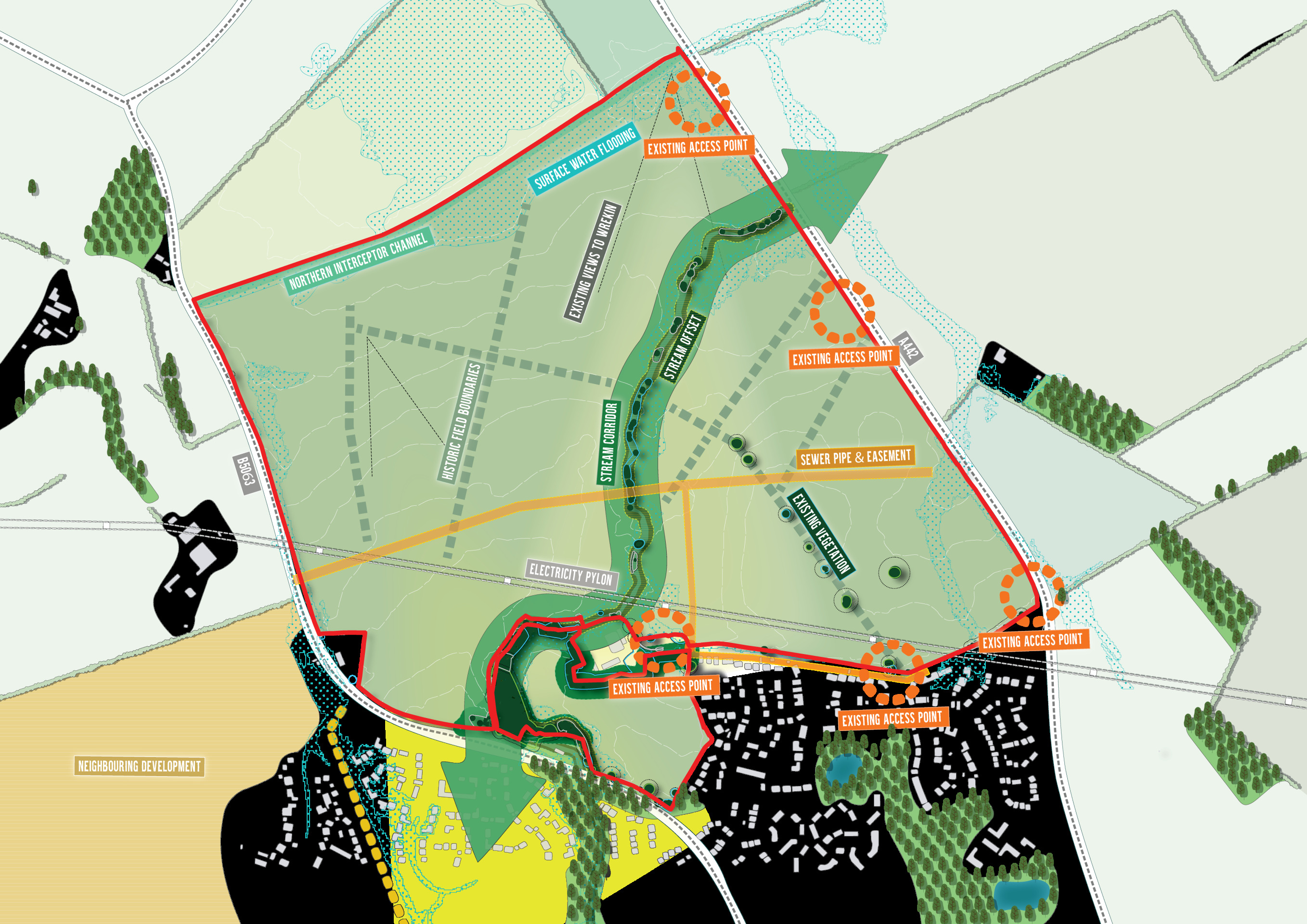
Site character plan showing existing features that will shape development - click to enlarge
A sustainable location to meet Telford’s future housing needs
The site directly adjoins the urban area of Telford, lying on the northern edge of Bratton and Shawbirch.
An existing bus route serves Glade Way, south of the site, connecting the area to Telford Town Centre as well as the wider Telford area. Telford has three train stations (Wellington, Oakengates and Telford Central) which provide a range of services including to Shrewsbury, Wolverhampton, Birmingham, Aberystwyth and Holyhead where onward connections are available.
While the site is sustainably located within easy reach of local facilities, given the scale of the proposed development, it is intended to provide a local centre alongside employment provision, play and open space, sports facilities and a primary school to ensure the delivery of a sustainable community.
As such, the site is in an entirely appropriate location to provide a sustainable extension to Telford, as reflected in its proposed allocation in the emerging Telford & Wrekin Local Plan Review to meet future housing needs in the period to 2040.
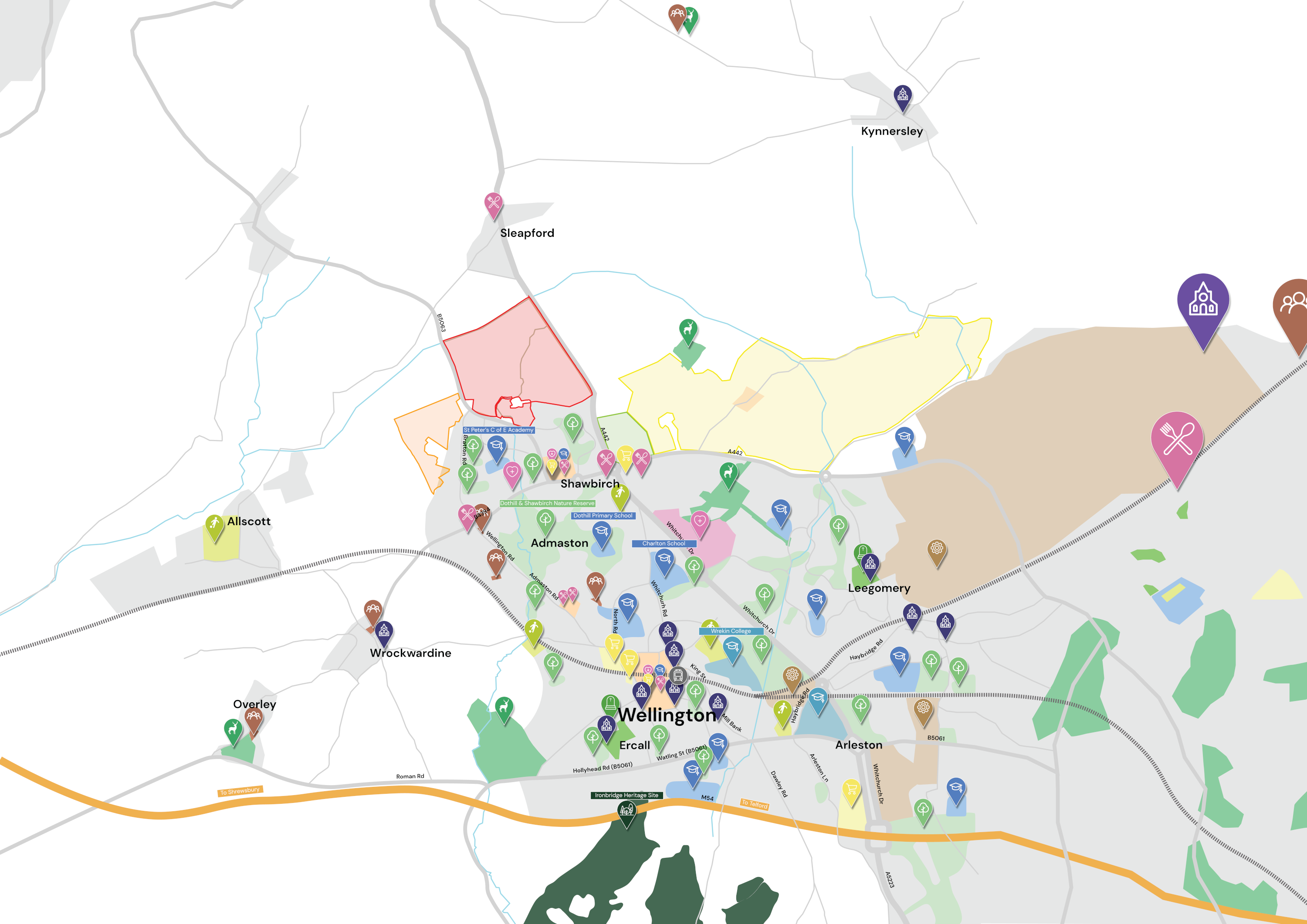
The site (shown in red) in relation to local services and facilities (as well as other proposed Local Plan Review allocations for growth) - click to enlarge