The Environment Agency (EA) Flood Map for Planning demonstrates that the majority of the site is located within Flood Zone 1, and as such is deemed to be at the lowest risk of fluvial flooding. However, the site does contain areas at medium to high flood risk, and this has been appropriately considered through the Local Plan Review within the Strategic Flood Risk Assessment (SFRA).
In terms of surface water, the Environment Agency produces the publicly available “Long-Term Flood Risk, Flood Risk from Surface Water Map”, which identifies the majority of the site is at very low risk of flooding and deemed to have less than a 1 in 1,000-Year chance of flooding (0.1% Annual Probability of Flooding) in any given year. However, there are areas of medium to high risk across the site, which will be managed within the development.
Bratton Green will incorporate a sustainable drainage system (SuDS) using an integrated approach to manage and store surface water, working with the Lead Local Flood Authority. The system aims to collect and slow down flows, and convey surface water across the site using landscaped vegetated conveyance swales which improves water quality before flowing to attenuation basins. These will be integrated within the green infrastructure strategy, making attractive features within the open spaces. This will provide a comprehensive, effective and multi-functional sustainable drainage solution for the site. In addition to managing surface water flows, these features also deliver biodiversity enhancements through the creation of new habitat features.
It is proposed that the foul sewerage will combine a gravity and pumped solution to outfall to the Severn Trent Water sewer which bisects the site.
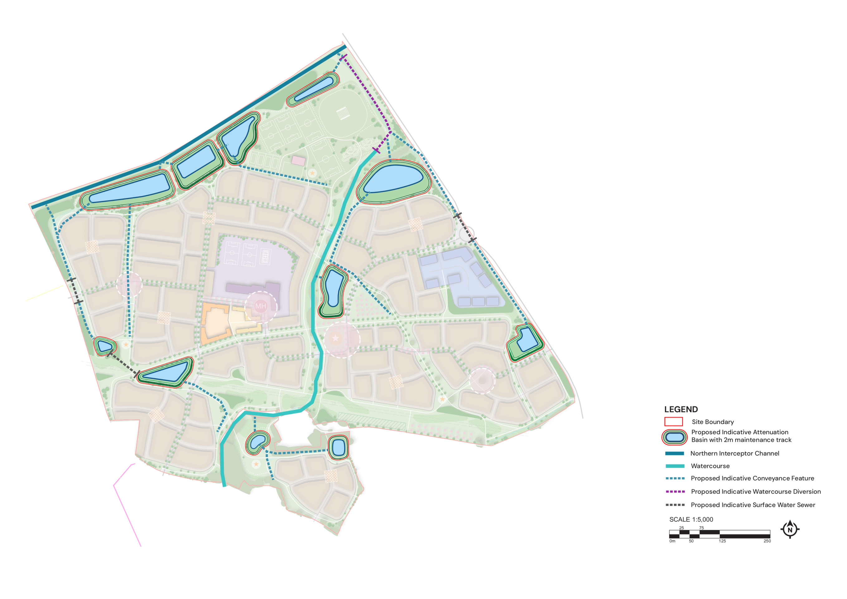
The Sustainable Drainage System proposed for Bratton Green - click to enlarge
The Sustainable Drainage System for Bratton Green will also deliver habitat and biodiversity enhancements